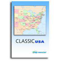
Classic USA - State Maps with Counties, Capitals, and Major Cities
MRCUSA-163010About This Map Collection
Indispensable maps of all 50 US State with county areas, county names, and major cities. Complete USA maps show state areas, state names or abbreviations, with capitals & major cities. Maps are in two popular styles: Black & White and Multi-Color.
Classic USA includes 160+ maps:
- 14 USA maps
- 50 US state maps, plus DC, each in 3 styles
- View all the maps in this collection.
Maps are Adobe Illustrator vector files, drawn in layers and fully editable so you can use the maps as-is, change or add color, rescale the map, or modify specs to suit your design needs. All text is editable font text (not outlines).
Royalty Free for most uses. Additional add-on licenses available for re-sale, multi-user, and electronic / broadcast uses.
The entire collection is available for immediate download when you purchase online. Download is a 18 MB ZIP archive.
How Will I Download My Digital Map File?
Your receipt page will have a link to download your file, and you will receive an email with the same link. The link will be active for 30 days.
30 Day Money-Back Guarantee!
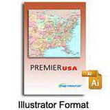
Download a Sample Map
See for yourself why our maps are the best! Download a fully editable sample map in Adobe Illustrator or PowerPoint Format.
Can't Find the Map You Need?
We can make one for you. Here's how to get a custom map...
Similar Maps